The Arctic Circle Trail (ACT) is a 165–200 km (depending on exact route) backcountry hiking trail in West Greenland, stretching from the former US Air Base at Kangerlussuaq to the fishing town of Sisimiut. Every year, several hundred hikers complete the trail, and one of the first decisions they face is which direction to walk: east-to-west (Kangerlussuaq to Sisimiut) or west-to-east (Sisimiut to Kangerlussuaq). While both directions cover the same terrain, differences in elevation profile, prevailing winds, logistics, and cultural experiences can make one direction more suitable for your preferences. This article provides a factual comparison to help you decide.
Overview of the Arctic Circle Trail
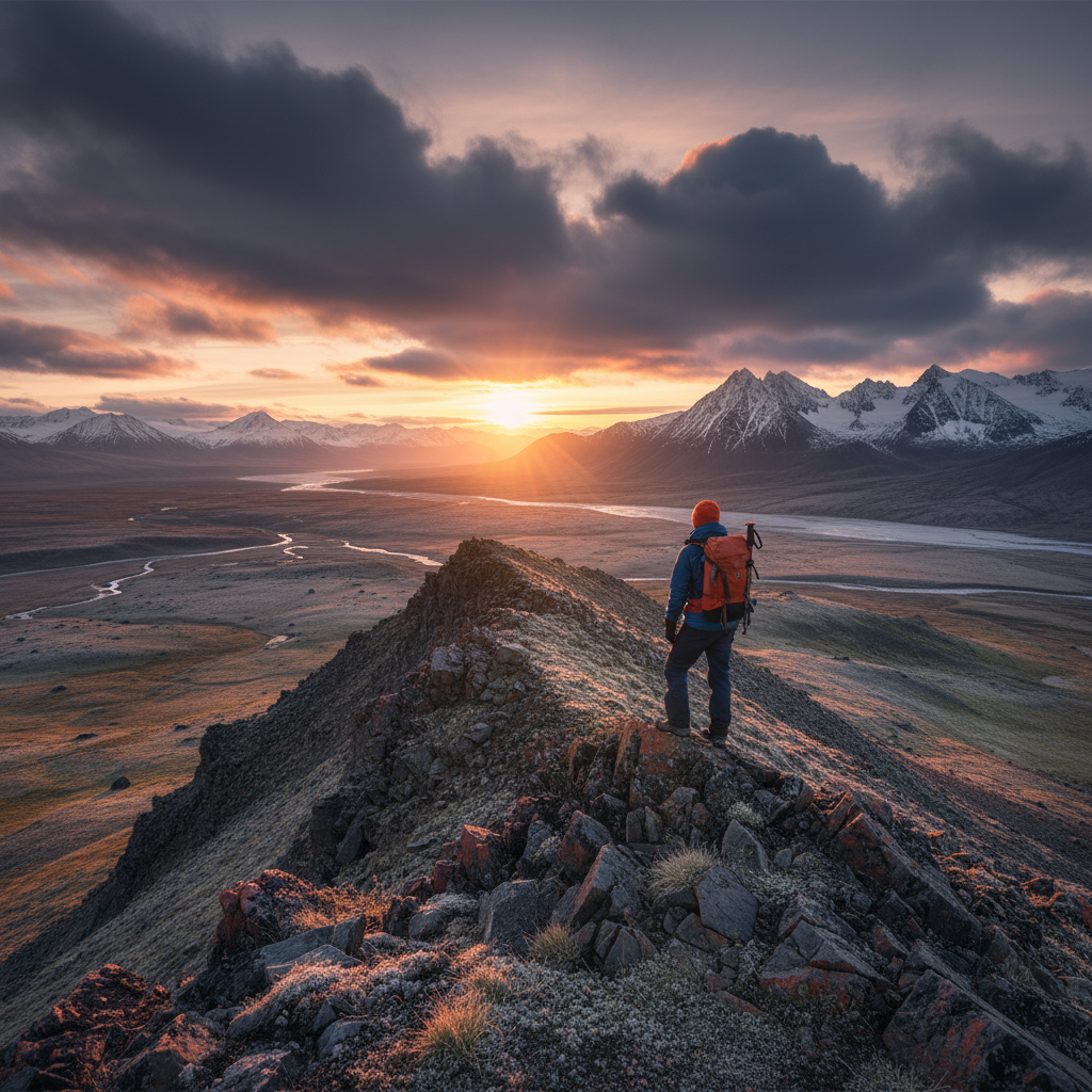
The Arctic Circle Trail is a point-to-point route that crosses the Greenland ice sheet margin through a landscape of tundra, lakes, and low mountains. The trail is not waymarked in the traditional sense but is marked by cairns and occasional red paint on rocks. It passes through 10 huts and numerous tent sites. The trail is typically hiked in 7–10 days, with daily distances of 15–25 km. The official trailhead in Kangerlussuaq is at the end of the road near the airport, while the Sisimiut trailhead is at the edge of town near the harbour.
Elevation Profile and Physical Demands
East-to-West (Kangerlussuaq to Sisimiut)
The trail starts at Kangerlussuaq at approximately 30 m above sea level and gradually climbs to a high plateau around 400–500 m, then descends to Sisimiut at sea level. The total ascent is about 1,200 m, and the descent is roughly 1,300 m. The first two days involve a steady climb through the Kangerlussuaq valley, with the most significant elevation gain on Day 2 (about 300 m). The highest point is near the ice cap at around 500 m. The descent from the plateau to Sisimiut is gentle but sustained over the final two days.
West-to-East (Sisimiut to Kangerlussuaq)
Starting from Sisimiut, you immediately climb out of the town, gaining about 200 m in the first few kilometres. The trail then continues with rolling terrain, with the most demanding climb on Day 2 (or Day 1 if you push far) up to the plateau. The total ascent is about 1,300 m, and descent about 1,200 m. The net elevation gain is slightly higher, and the initial steep climb can be challenging with a full pack. Many hikers find the west-to-east direction more strenuous due to the early ascent and the fact that the final approach to Kangerlussuaq is a long, flat walk along a gravel road.
Prevailing Winds and Weather
Greenland’s weather is dominated by the ice cap, and the prevailing wind direction is from the east, off the ice. This means that walking east-to-west often gives you a tailwind, which can be a significant advantage in terms of comfort and energy expenditure. Conversely, walking west-to-east means you are more likely to face a headwind, especially on the open plateau. Wind speeds on the plateau can exceed 30 km/h, and gusts can make progress difficult. However, weather is unpredictable, and you may encounter calm conditions regardless of direction.
Logistics: Getting to the Start and Leaving the Finish
East-to-West
Starting in Kangerlussuaq is logistically simpler for many international hikers because Kangerlussuaq Airport receives direct flights from Copenhagen (Air Greenland) and seasonal flights from Iceland (Air Greenland and Icelandair). You can fly into Kangerlussuaq, start hiking immediately, and finish in Sisimiut, which has a harbour and an airport with flights to Nuuk and other Greenlandic towns. From Sisimiut, you can fly back to Kangerlussuaq or onward to Nuuk. Alternatively, you can take the Sarfaq Ittuk coastal ferry from Sisimiut to other settlements.
West-to-East
Starting in Sisimiut requires you to get there first. Sisimiut is accessible by Air Greenland flights from Nuuk (50 min) or Kangerlussuaq (20 min), or by the coastal ferry. If you fly into Kangerlussuaq, you would need to take a flight or ferry to Sisimiut before starting. After finishing in Kangerlussuaq, you can fly out from Kangerlussuaq Airport. Some hikers find it easier to fly into Kangerlussuaq, hike east-to-west, and then fly out from Sisimiut, avoiding extra travel.
Sunlight and Timing
The Arctic Circle Trail is hiked during the summer months (June to August), when daylight is nearly 24 hours in the north. However, the sun’s position affects the direction you walk. Walking east-to-west in the afternoon means the sun is behind you, reducing glare and keeping you warmer. In the morning, the sun is in front, but you can adjust your hiking schedule. West-to-east hikers face the sun in the afternoon, which can be harsh on clear days. Additionally, the midnight sun (north of the Arctic Circle) means the sun never sets, but its low angle can create long shadows and make navigation trickier.
Navigation and Trail Finding
The trail is marked with cairns, but some sections are more obvious than others. The eastern section (Kangerlussuaq side) is on relatively flat terrain with fewer rocks, making the trail easier to follow. The western section (Sisimiut side) has more boulder fields and complex terrain where cairns can be harder to spot. Hiking east-to-west means you encounter the more challenging navigation near the end when you are more tired, while west-to-east puts the trickiest sections early on. Some hikers prefer to have the easier navigation at the start to build confidence.
Cultural and Scenic Highlights
East-to-West
Starting at Kangerlussuaq, you experience the transition from the barren, desert-like landscape near the ice cap to the greener, more vegetated coastal area. You pass by the Russell Glacier, a popular day hike from Kangerlussuaq. As you approach Sisimiut, you get views of the sea and the town. The final descent into Sisimiut offers a dramatic view of the harbour and the surrounding mountains. Many hikers enjoy the sense of progression from the ice cap to the coast.
West-to-East
Starting in Sisimiut, you immediately climb into the mountains and head inland. The scenery changes from coastal heath to high plateau. You miss the gradual build-up but get to see the ice cap from a distance earlier. The final approach to Kangerlussuaq is along a gravel road, which can be less scenic. However, you end at the airport, which is convenient for departure.
Hut Availability and Camping
The huts along the trail are spaced approximately 15–20 km apart. If you hike east-to-west, the first hut (Kangerlussuaq) is at the start, then you have huts at Hundesø, Katiffik, etc. The hut at Eqalugaarniarfik is a popular stop. West-to-east, the first hut from Sisimiut is Kangerluarsuk Tulleq, then Nerumaq, etc. The direction does not affect hut availability, but your daily distances will determine which huts you use. The huts are free and available on a first-come, first-served basis; they have sleeping platforms, a stove, and basic equipment. Camping is allowed anywhere along the trail.
Physical Preparation and Pack Weight
Regardless of direction, the trail requires carrying all your food and gear. A typical pack weight is 15–20 kg. The east-to-west direction may be slightly easier on the knees because the descent is gradual, while west-to-east has a steeper descent near the end (or a long flat walk). However, the differences are minor. The Arctic Circle Trail packing list recommends lightweight gear to reduce fatigue.
Which Direction Is More Popular?
Based on anecdotal reports from hut logbooks and online forums, approximately 60–70% of hikers choose east-to-west (Kangerlussuaq to Sisimiut). This is likely due to the logistical convenience of starting at the international airport and the tailwind advantage. The remaining 30–40% hike west-to-east, often to have the more challenging terrain first or to end at the airport for a quick departure.
Recommendations Based on Your Priorities
- If you prioritize convenience: Hike east-to-west. Fly into Kangerlussuaq, hike to Sisimiut, and fly out or take the ferry. This avoids extra travel to the start.
- If you want to avoid headwinds: Hike east-to-west for a higher chance of tailwinds.
- If you prefer a gradual start: East-to-west has a gentler first day, which helps acclimatisation.
- If you want to end at the airport: Hike west-to-east to finish in Kangerlussuaq and fly out immediately.
- If you want the hardest part first: Hike west-to-east to tackle the steep climb out of Sisimiut early.
- If you are concerned about navigation: East-to-west puts the easier navigation at the start, building confidence.
Practical Considerations
Food and Supplies
Both Kangerlussuaq and Sisimiut have supermarkets (Pisiffik in Sisimiut, Brugseni in Kangerlussuaq) where you can buy food for the trail. However, selection is limited, and prices are high (e.g., a loaf of bread around 30 DKK, a can of beans 15 DKK). It is advisable to bring freeze-dried meals from home or order online. The complete guide to Sisimiut provides more details on local shopping.
Water
Water is plentiful along the trail from streams and lakes. No purification is needed, but some hikers use filters for peace of mind. The water is generally safe.
Wildlife
You may encounter musk oxen near Kangerlussuaq and reindeer throughout the trail. Mosquitoes can be abundant in July; a head net and repellent are essential.
Conclusion
Both directions offer a rewarding wilderness experience. The east-to-west direction is slightly more popular due to logistical ease and prevailing winds, but west-to-east has its own merits. Consider your travel plans, physical condition, and preferences before deciding. For more detailed information, read the Arctic Circle Trail complete hut-to-hut guide.
Related Articles
- The Complete Guide to Sisimiut, Greenland 2026
- How to Get to Sisimiut 2026: Flights, Ferries, Routing
- Air Greenland Routes to Sisimiut, Kangerlussuaq, Nuuk
- Sarfaq Ittuk Coastal Ferry Sisimiut
- Arctic Circle Trail Packing List: Ultralight Comfort